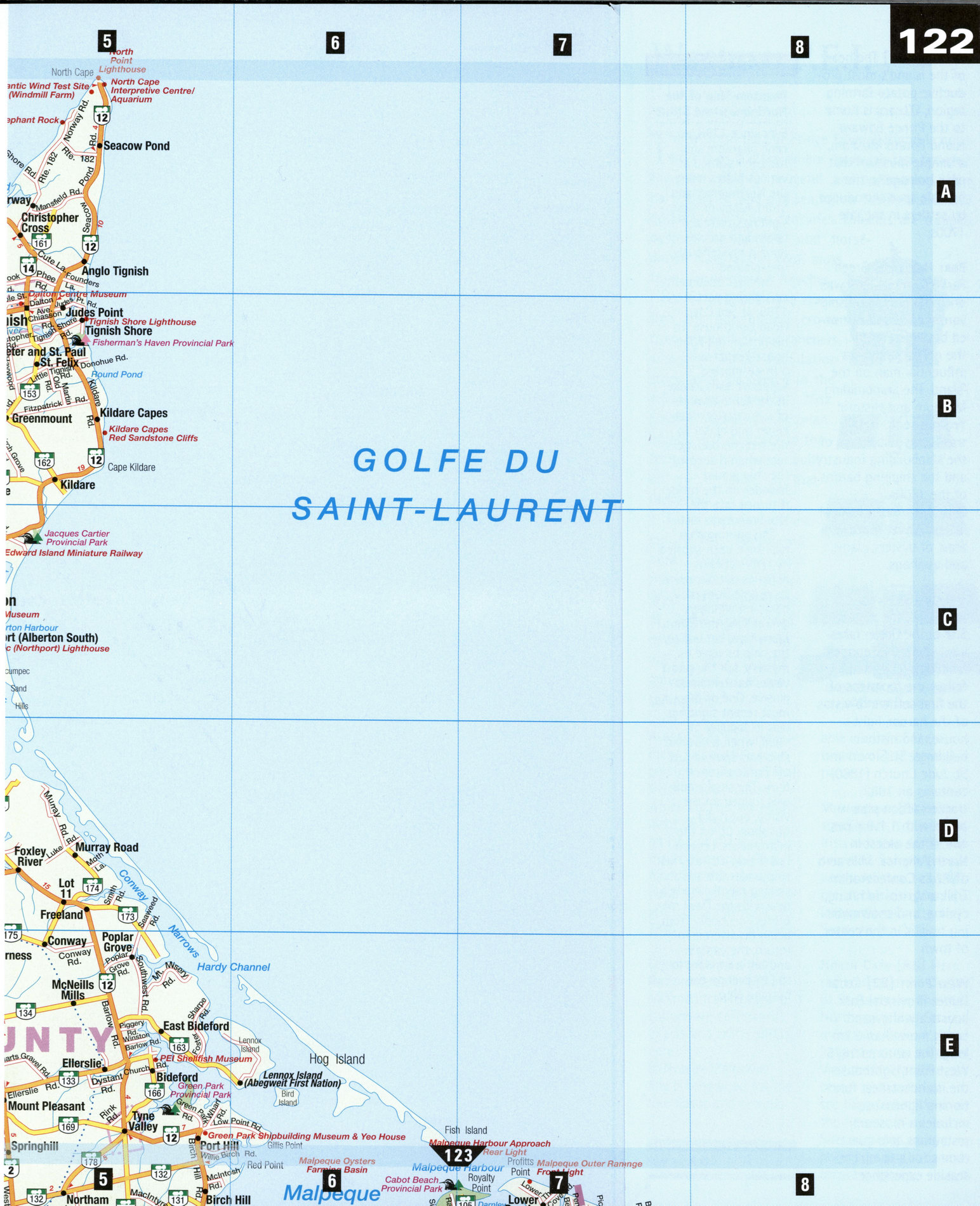
Large map of Western PEI Prince Edward Island Canada
Highways map of Western part of Prince Edward Island PEI Canada
Free map of Western P.E.I. Prince Edward Island. Detailed map of the highway and local roads of Western P.E.I. with cities and towns.


Road map of western part of Prince Edward Island PEI Canada
Western P.E.I.
The western part of Prince Edward Island is noteworthy as a place where roads are less traveled; the pace of life peaceful and welcoming. Here harvesters of land and sea follow family trades that go back nearly two centuries. Lobsters are trapped, oysters are tonged, and horse-drawn rakes gather Irish moss from storm-tossed beaches. Fields of potatoes have wrestled the agricultural crown from early silver-fox ranchers, whose breeding foundation stock were discovered in the wild near Alberton. "Fox houses," beautiful Victorian homes, give evidence to the fortunes that were built on the offspring of that lucky find.
For a true feel of the pull of the marine past here, climb out onto the lantern deck of the West Point Lighthouse at Cedar Dunes, and imagine yourself on watch duty in the crow's nest of an old sailing ship.
Alberton [C4] A monument just outside town commemorates the local silver-fox fur industry, which created the equivalent of a gold rush on P.E.I, at the turn of the 20th century. The Alberton Museum displays furnished rooms of affluent Islanders of the 18th and 19th centuries.
Lennox Island First Nation Reserve [E6]
Mi'kmaq traditions and culture are celebrated in arts and crafts shops here.
О Nearby Malpeque Bay is renowned for the fine flavor and remark-able quality of the oysters of the same name.
Miminegash [B3] This small town is famed for Irish moss, an edible red seaweed. Sample the area's delicacy, seaweed pie, at the Irish Moss Interpretive Centre and Seaweed Pie Cafe.
North Cape [A5] Here the waters of the Gulf of St. Lawrence and the Northumberland Strait meet over Canada's longest natural rock reef. Visit the interpretive center and aquarium, see the windmill farm at the Atlantic Wind Test Site, and keep an eye peeled for sea birds and mossing horses.
O'Leary [D3] The heart of the island's most productive potato farming region, O'Leary is home to the Prince Edward Island Potato Museum, a unique museum that pays homage to the humble spud introduced by settlers in the late 1700s.
Port Hill [E5] Green Park Provincial Park was once the home and shipyard owned and operated by James Yeo, Jr., the richest and most influential man on the island. The Shipbuilding Museum and Historic Yeo House (c. 1864) traces the golden age of the shipbuilding industry and the shipping barons of the 1800s. ® A midsummer festival in Tyne Valley features a feast of oysters, clams, and quahogs.
TlGNISH [B5]
In Tignish, the Historic Site at the Green takes you where the founders landed in 1799. Trails follow the footsteps of the first settlers to vistas of the harbor, lighthouse, and historic buildings. St. Simon and St. Jude Church (1860) contains an 1882 tracker-action pipe organ with 1,118 pipes, one of the oldest in North America. Mile zero of P.E.I.'s Confederation Trail, a tip-to-tip hiking, cycling, and snowmobil-ing trail, is in the center of town.
West Point [E2] Cedar Dunes Provincial Park boasts a white-sand beach more than 2 km long. The restored 1875 West Point Lighthouse— the island's tallest functioning lighthouse-includes a museum, restaurant, and guest rooms for a complete seaside experience.
LOCAL LORE
Phantom Ship of the Northumberland Strait
Ever since 1786, an eerie phantom ship has been sighted at various places along the Northumberland Strait. Many of these sightings, recorded in books and articles, remain mysteriously unexplained.
The first documented sighting was in 1786, at Sea Cow Head Lighthouse. To his horror, the lighthouse keeper saw a three-masted schooner, sails ablaze in the terrible winds of a nor'easter, draw closer and closer to the treacherous rocks. Just when it seemed the ship would founder on the rocks, it turned into the storm and was lost.
The burning ship has since been spotted by ferry captains, fisheries patrols, even by people from their bedroom windows overlooking the Strait. Many have set out to the ship to solve its mystery, but the ghost vessel has remained elusive. One of the most recent sightings was in January of 1988, when a burning ship was spotted just off Borden from the ferry. The ship's radar was trained on the vision, but it did not show up on the instruments. Legend has it that a pirate, his ship under fire and sinking rapidly, made a deal with the Devil to protect his booty from being discovered. In return, the captain and his crew were to sail forever on the burning ship