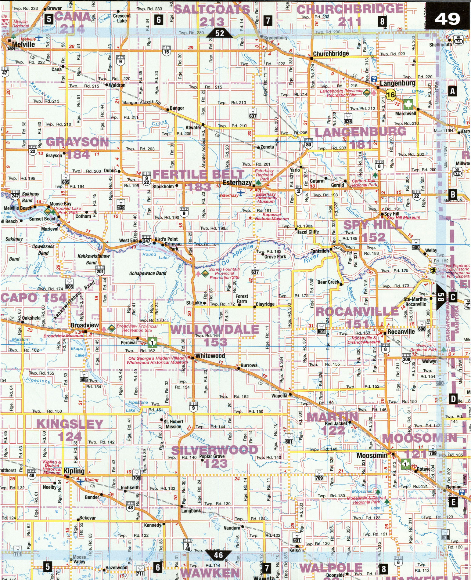
Road map Carlyle city surrounding area (Saskatchewan, Canada)
Road map of Fort Qu'Appelle city area (Canada)
Map of Qu'Appelle Valley. Detailed map of the highway and local roads of Qu'Appelle Valley with cities and towns.


Free road map of Fort Qu'Appelle city area (Canada)
Map of Qu'Appelle Valley. Detailed map of the highway and local roads of Qu'Appelle Valley with cities and towns.
Qu'Appelle Valley
Originating in Lake Diefenbaker, the Qu'Appelle River meanders east to join the Assiniboine in Manitoba. At Fort Qu'Appelle, the river enters a valley, some 140 m deep and 2.5 km wide, which eon-tains a chain of sparkling lakes. For drivers traveling across the level prairie, descending into this valley may come as a delightful surprise. Two provincial parks-Echo Valley and Katepwa Point-invite visitors to linger by the lakeshores. Near Abernethy, north of the valley, Motherwell Homestead revives Saskatchewan farm life in the early 1900s.
Esterhazy [B7] This community sits on an immense potash deposit, which stretches in a kilometer-deep band across central Saskatchewan. Esterhazy has prospered since the local potash mine-reputedly the world's largest of its kind-began operating in 1962. Kaposvar Historic Site Museum, south of town, honors the Hungarian colonists who settled here in 1886 under the auspices of Count Paul Esterhazy.
Fort Qu'Appelle [A2]
Tucked away in the Qu'Appelle Valley, this town was born as a Hudson's Bay Company post in 1864. The museum, adjoining a small restored log building
from the original post, puts on show Native and pioneer artifacts. Treaty Four Park marks the site of the 1874 signing of an important treaty between the Cree, the Saulteaux, and British crown. In September, this key event is recalled at Treaty No. 4 Gathering, organized to focus on Native culture and issues.
Indian Head [C2] Born in 1882, the community takes its name from a nearby range of hills. South of town, a tree nursery has been supplying prairie farmers with seedlings for shel-terbelts since 1902. Now part of the Prairie Farm Rehabilitation Administration, its grounds abound with flowers, trees, and shrubs suited to prairie growing conditions.
Visitors can picnic on the grounds, stroll along a kilometer-long nature trail, or arrange tours here. At the east end of town, the Dominion Experimental Farm welcomes picnickers, too. It has been engaged in research since 1887, when it was the first site of its kind in western Canada.
Melville [A5] With some 5,000 inhabitants, Melville is Saskatchewan's smallest center with city status. It began to grow when chosen as a divisional point on the Grand Trunk Pacific Railway (now Canadian National). The name of the city honors GTPR President Charles Melville Hays, who went down with the Titanic in 1912. The Railway Museum salutes Melville's rail connections.
Motherwell Homestead National Historic Site [B3] Farm life and methods of the early 1900s is the theme of this site near Abernethy. The homestead once belonged to William Motherwell, an Ontarian who settled here in the early 1880s. Motherwell eventually became agriculture minister in the Saskatchewan and federal governments. Just as in 1912, the homestead is arranged in four distinct parts: a water reservoir, a vegetable patch, an L-shaped barn, and Motherwell's 1896 stone dwelling, furnished in Victorian style. The staff performs bygone tasks, or works the fields with vintage farm gear. Visitors are invited to lend a helping hand with the chores.
ATTRACTIONS
ABERNETHY
Motherwell Homestead National Historic Site
BROADVIEW
Broadview Museum Grasslands National Park (Visitors Centre) Perrault's Museum
ESTERHAZY
Kaposvar Historic Site Museum
FORT QU'APPELLE
Fort Qu'Appelle Museum Treaty Four Park
GRENFELL
Grenfell Museum
INDIAN HEAD
Dominion Experimental Farm Indian Head Museum PFRA Shelterbelt Centre
MELVILLE
Melville Heritage
Museum Railway Museum
MOOSOMIN
Jamieson Museum
ROCANVILLE
Rocanville and District Museum The world's largest oil can
WHITEWOOD
Old George Authentic
Collectibles Whitewood Historical Museum