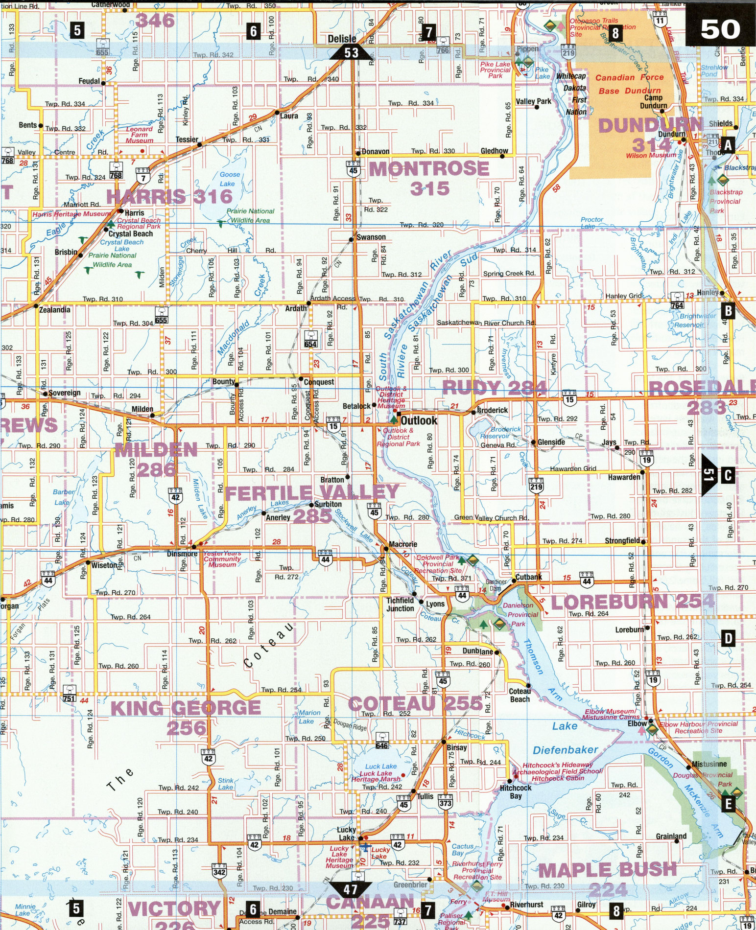
Road map Carlyle city surrounding area (Saskatchewan, Canada)
Road map Outlook city area (Canada)
Outlook city highway and road map. Detailed map of highway and roads of Outlook (Saskatchewan, Canada).

Large scale road map Outlook city area (Canada)
Outlook city highway and road map. Detailed map of highway and roads of Outlook (Saskatchewan, Canada).
The Gardiner Dam
The mighty Gardiner Dam, and the high, impounded waters of Lake Diefenbaker, are two of Saskatchewan's must-see sights. The damming of the swift-flowing South Saskatchewan River provides a bounty of power and irrigation of the province's economy, as well as a recreational bonus for its citizens. Within easy reach of the Gardiner Dam, quieter destinations-a prairie village such as Eston, for example-also beckon to the curious traveler.
Danielson Provincial Park [D7] A popular spot for water-sports enthusiasts and campers, this park occupies Lake Diefenbaker's west and east shores beside the Gardiner Dam. The visitor center, on the west side, has displays about the lake and its benefits. It also contains exhibits about the animal and bird life seen on the park's hiking trails or along the lakeshore.
Eston [D2] The restored 1910 Evans House and Lovedale school are highlights of Eston's Prairie West Historical Centre. Among 3,000 items on display are furnishings and photographs from frontier times. This village of 1,000 inhabitants is a center for a productive grain-growing region.
Gardiner Dam [D7]
Canada's largest earth-filled dam boasts impressive dimensions: 5 km long, 64 m high, and 1.6 km wide at the base. Completed in 1967, the dam created 225-km-long Lake Diefenbaker, a water source for more than a third of the province. It is named for Saskatchewan premier and federal agriculture minister James C. Gardiner (1883-1962), one of the chief political figures who pressed for its development. DCoteau Creek Hydroelectric Station, below the dam, produces a million megawatts of electricity a year. A tour from the Danielson visitors center tells how the plant works. A drive across the dam reveals dramatic differences in water levels-up to 60 m-between the very high Lake Diefenbaker behind the dam and the South Saskatchewan River below it.
Herschel [b3] Because the area around Herschel was farmed, prehistoric bones and evidence of early Native habitation remained undisturbed until the early 1990s. Herschel's Ancient Echoes Interpretive Centre, housed in the old school, displays recently discovered skeletal bits and pieces of plesiosaurs and other denizens of a sea that covered this area millions of years ago. SJThe center also describes the mysterious petroglyphs—lines, circles, and dots carved on huge boulders in this area-inscribed by early Native peoples. Beside the carved boulders, archaeologists have dug up layers of objects from ages past. Upper-layer finds include glass beads and pieces of china from early traders or settlers. Lower layers have yielded 600-year-old stone shards and a buffalo bone over 1,000 years old. Visitors can arrange tours to the fossil and petroglyph sites at the interpretive center.
Lucky Lake Heritage Marsh [E7] This spot attracts 200 migrating bird species in spring and fall. Tundra swans visit in May and June; Hudsonian godwits, in late summer. A nature trail, located just off Hwy 646, leads to the marsh.
Ruthilda [A2] The Stopping Place, a pioneer-style farmstead, offers warm welcome here. Visitors can sup in an antique-filled dining hall, and inspect the petting zoo and old-time farm gear on the grounds. OOpuntia Lake Bird Sanctuary, just south of Ruthilda, is a haven for tens of thousands of migrating ducks and geese during the spring and fall. Some 2,000 sandhill cranes and 500 tundra swans congregate here in the fall; spotted sandpipers, American avocet, Wilson's phalarope, and Baird's sparrow are some species that breed here.
ATTRACTIONS
ESTON
Prairie West Historical Centre
HERSCHEL
Ancient Echoes Interpretive Centre
LUCKY LAKE
Lucky Lake Heritage Marsh
RUTHILDA
Opuntia Lake Bird
Sanctuary The Stopping Place