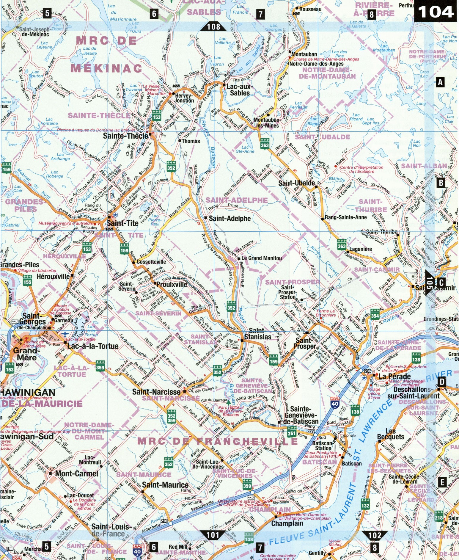
Map of Mauricie National Park, Quebec Canada
Free large map of Mauricie National Park Quebec Canada
Map of Mauricie national park. Detailed map roads of Mauricie national park.


Detailed map of Mauricie National Park Quebec Canada with roads and towns
Map of Mauricie national park. Detailed map roads of Mauricie national park.
The Mauricie
Bounded by the Laurentian plain to the south and the Canadian Shield to the north, the Mauricie affords a remarkable range of vistas. The main river of the region is the mighty Saint-Maurice, with its 587-km-long drainage basin. The region was first named in 1933 by Monseigneur Albert Tessier and stretched from Trois-Rivieres further south to Lac Saint-Jean further north, a vast territory of 39,748 km2 speckled with large bodies of water and expansive woodlands. Today, "La Mauricie" commonly refers to the towns along the Saint-Maurice, Batiscan, and Sainte-Anne rivers, and the area around the city of Shawinigan and La Mauricie National Park. While the Mauricie region was built on logging, steel, and hydroelectric power, what you'll notice above all else is the tranquillity of its landscapes and its people's unending hospitality.
Batiscan [E8] It was near Batiscan in 1609 that Champlain first met the Huron people, who would become allies of the French. Today this small village is known for its Old Presbytery, a handsome fieldstone house constructed by the Jesuits in 1816.
Grand-Mere [D5] Like Shawinigan, this town's name has Algonquin roots: according to legend, Grand-Mere is named after a century-old rock formation that resembles an elderly woman's head. (In Algonquin, Kokomis means "grandmother.") This odd stone was moved from the base of the local falls to its present site, between 5e and 6e Avenues, in 1916. The hydroelectric power station was inspired by the Sainte-Cecile Cathedral of Albi, France, and the city's grand suspension bridge was the first of its kind in Canada.
La Mauricie National Park [B2-4] Created in 1970 to protect a section of the southernmost part of the Canadian Shield, La Mauricie National Park is an outdoor lover's paradise. Stroll or bike along the extensive network of trails, including the 63 km Promenade Road, which crosses through the park. Hike alone or with a naturalist guide, try a rabaska canoe (a large canoe propelled by 8 to 10 rowers), or stay at the stately, late-19th-century Wabenaki and Andrew Lodges on the shore of Lac a la Peche.
La Perade [D8] Located where the Sainte-Anne River meets the St. Lawrence, this picturesque village offers a well-preserved 18th-century seigneury, Manoir Madeleine-de-Vercheres, with ornamental, medicinal, and aromatic gardens. In winter, the town becomes a hot spot for tommycod fishing on the Sainte-Anne River. OThe magnificent neo-Gothic church on Rue Sainte-Anne was built between 1855 and 1869 by Montreal architect Casimir Coursalle, who was inspired by Montreal's famous Notre-Dame Basilica.
Saint-Tite [B5-6] First settled by French Canadians in the mid-19th century, Saint-Tite is renowned for its leather industry and Western character, seen in the town's Old West-style facades (including the Town Hall) and Western Festival, which draws over 400,000 rodeo fans to the area each September.
Shawinigan [D4] The native Algonquins first used Achewenegan ("crest") to describe one of the area's majestic waterfalls, because they needed to scale a crest of rocks to portage around it. Today, Shawinigan is nicknamed "Niagara of the East," and its five waterfalls have played a key role in the industrialization of Canada. A heritage circuit for history buffs, boat cruises along the Saint-Maurice River, and the new Cite de I'energie (City of Energy) theme park, all offer a look at the area's industrial history. The park's observation tower, at over 115 m high, also has a spectacular view of the surrounding region.ATTRACTIONS
BATISCAN
Old Presbytery Les Rapaillages Wood Factory Chemin du Roy Art Gallery
GRAND-MERE
Rocher de Grand-Mere (Grand-Mere Rock) Hydroelectric Power Station Cultural Centre Grand-Mere Bridge Karting International Grand-Mere (go-cart racing)
LA MAURICIE NATIONAL PARK
Saint-Jean-des-Piles
Tourism and Interpretation Centre Wabenaki and Andrew Lodges Promenade Road
LA PERADE
Sainte-Anne-de-la-Perade Church
Domaine seigneurial Sainte-Anne (Madeleine-de-Vercheres Historic Site)
SAINT-TITE
Musee Souvenirs d'Autrefois (historical museum) Saint-Tite Town Hall and Clock Tower
SHAWINIGAN
La Cite de I'energie theme park Shawinigan Art Centre Saint-Maurice River
Boat Cruises Saint-Maurice River Promenade Heritage Circuit Shawinigan Linear Park Pare des chutes de Shawinigan (Shawinigan Falls Park)