Road map Madoc and Tweed city surrounding area (Ontario, Canada)
Road map of Madoc and Tweed (Province Ontario, Canada)
Map of Madoc & Tweed. Detailed map of roads of Madoc & Tweed (Addington Highlands, Canada).
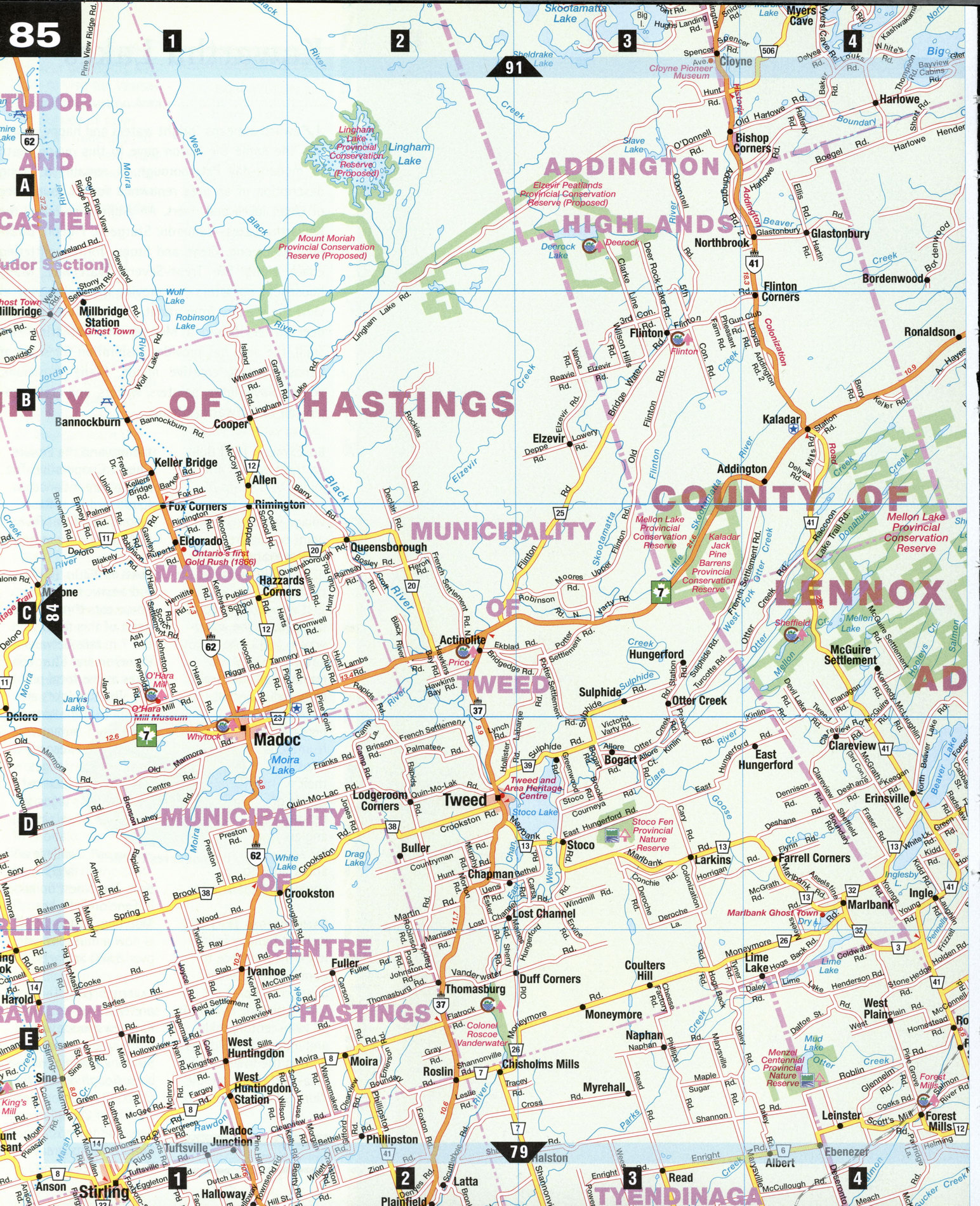
Large scale road map of Madoc and Tweed (Province Ontario, Canada)
Map of Madoc & Tweed. Detailed map of roads of Madoc & Tweed (Addington Highlands, Canada).
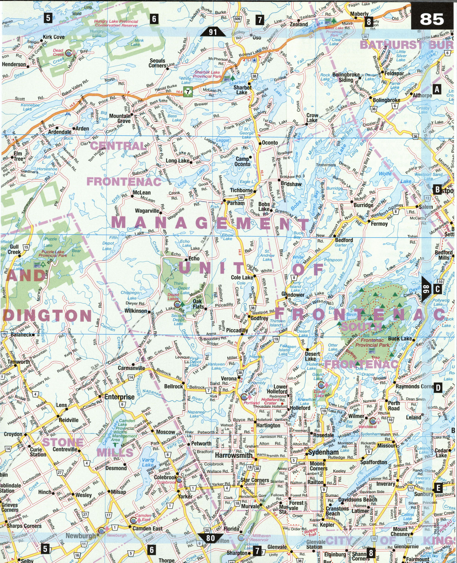
Addington Highlands
The Addington Highlands and the counties of Hastings and Frontenae to the south were primarily settled by Loyalists in the 1800s as they pushed northward from the St. Lawrence River and Lake Ontario. This is a land carved by the mighty forces of glaciers and meteorites. (The Holleford Crater, a circular depression about 30 m deep by 2.35 km across, is believed to be the result of a meteorite impact over a half-billion years ago.) The settlers found pockets of fertile land interspersed among the bedrock of the Canadian Shield, which led to dairy and cheese factories that carry on today. The gold rush of the late 1860s lead to more prospecting and exploration, with frenzied railway building to accommodate the mines and logging operations. Today the abandoned rail beds make up an extensive network of hiking and biking trails.
Cloyne [A3] From Kaladar to Cloyne and leading on to Denbigh to the north, present-day Hwy 41 follows the Historic Addington Colonization Road. The picturesque highlands here feature granite outcroppings and deciduous forests splashed with dark blue lakes. The highway is at its busiest in summer with campers, cottagers, boaters, and fishermen. Cloyne provides a variety of services, from bakeries to bait shops. The Pioneer Museum is a good place to experience the spirit of the north country: this one-room log cabin features the history and artifacts of the local area.
Frontenac Provincial Park [C8-D8] This provincial park encompasses 5,214 hectares of wilderness on the southern Canadian Shield. While camping sites are accessible only by hiking or canoeing, a series of popular hiking trails thread through the park, ranging from a few minutes' walk to eight hours or more. In the northern zone, marble ridges, rock outcrops, and mature deciduous forests are featured in the Testmine Loop. The popular Doe Lake Loop, which takes about two hours to complete, skirts two beaver ponds and climbs to a spectacular lookout over Doe Lake.
Ivanhoe [E1] Dairy farms are a large industry here; at the turn of the century there were over 100 cheese factories located within Hastings County. The Ivanhoe Cheese Factory is a stop along the Cheese Route, which goes as far south as Trenton, and includes factories like Black Diamond Cheese, Reid's Dairy, Riverside Cheese Factory, and the Stirling Creamery. All offer high-quality cheddar and specialty cheeses year-round.
Madoc [D1] Known as "The Heart of Hastings County," Madoc was founded around a mill and for a short time was called Hastings, before it was renamed after Prince Madoc of Wales. Moira River and Moira Lake have rare wetland plants attracting naturalists and canoeists. Northwest of Madoc is the O'Hara Mill Pioneer Village and Conservation Area, where the original O'Hara sawmill, a log school house, a blacksmith shop, pioneer machinery, and O'Hara House (1850) preserve 100 years in the domestic and agricultural life of the O'Hara family.
Tweed [D2] Named after a river in Scotland, Tweed and the surrounding Land O'Lakes area boast scenic rolling hills of grain and pasture lands, dotted with livestock and beautiful farmhouses. Tweed's Heritage Centre and Tourist Bureau is located in the Houston House (c.1897) and features a museum, archives, and a genealogical research center, and walking and driving tour descriptions for the Tweed and Land O'Lakes area. ©Tweed has a vibrant community of artists who open their studios the last weekend in September. Nineteen artists in diverse mediums-woodworking to watercolor, oil painting to native art, pottery to jewelry-making-participate in the annual studio tour.
Ontario's First Gold Rush
Ontario's first gold rush did not occur in the mineral-rich north of the province, but rather in Hastings County. In August of 1866, prospectors near Eldorado were digging in a likely area when the floor of their pit collapsed and dropped them into a small cave. The walls and ceiling of this cave contained pure gold nuggets. This became the Richardson Gold Mine, which though a spectacularly rich find, was too small to be a commercial success. Nevertheless, gold rush fever struck and thousands of miners and speculators from B.C., California, and elsewhere soon descended on Eldorado. Other gold deposits were found at Malone and then Deloro, where in the 1890s there were 20 gold mines operating. Prospecting in the area continues to this day.