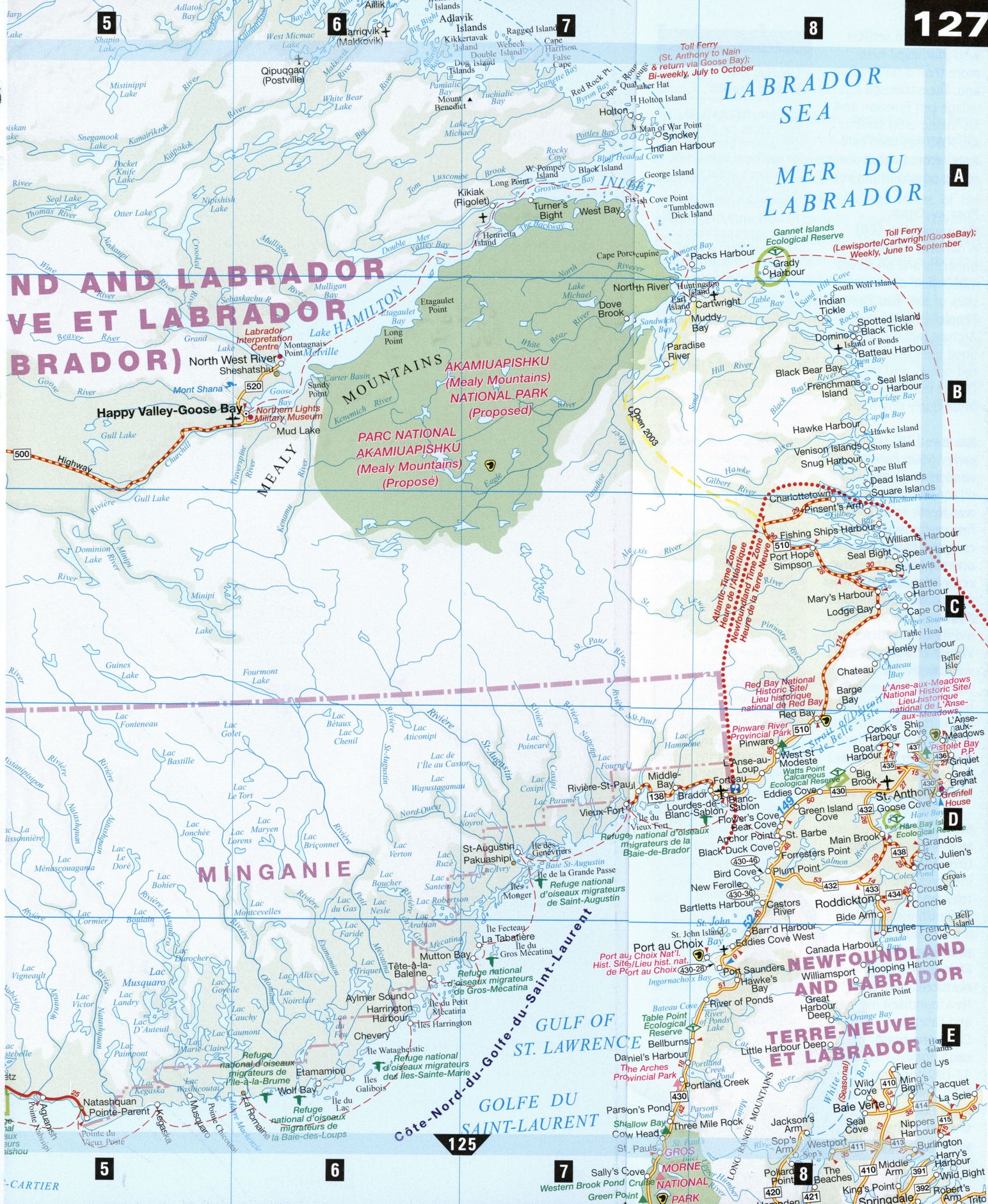
Highway map of Labrador Peninsula with cities
Highways map of Labrador with cities
Road map of Labrador. Detailed map of the highway and local roads of Labrador with cities and towns.


Free road map of Labrador with cities
Road map of Labrador Canada. Detailed map of the highway and local roads of Labrador with cities and towns.
Labrador road map
Along with the northern peninsula of Newfoundland, Labrador is a must for history buffs. A world of towering mountains, massive rock faces, huge lakes and rivers carved by eons of glacial action and internal upheaval, Labrador has traces of the oldest civilizations in Canada, from the Maritime Archaic Indians and Dorset Inuit, who tamed Labrador's harsh wilderness as the glaciers receded, to the Norse, who crossed the Atlantic to the New World 500 years before Cabot and Columbus.
Today, both Natives and settlers along Labrador's coast pursue lifestyles determined by climate and ecology. Coastal boats call at more than 40 communities during the summer shipping season, taking passengers to otherwise inaccessible coastal regions.
Churchill Falls [B3]
Located where the Churchill River drops 300 m in a 32 km stretch, Churchill Falls is built around one of the world's largest hydroelectric generating stations. You can arrange to tour the facility, much of which is located in an enormous man-made cavern.
Forteau [D8] Famous for its August Bakeapple Festival, three days of music, dance, food, and crafts, Forteau is also the site of the Point Amour Lighthouse, at 33 m the second tallest in Canada. The lighthouse began shining in 1858, guiding ships through the Strait of Belle Isle, burning whale oil to power the light. Still in use, it is now a maritime history interpretation center. S)Nearby L'Anse-Amour is the site of a stone-covered Maritime Archaic Indian burial mound dating back some 7,500 years.
Happy Valley-Goose Bay [B6] Goose Bay grew up around an air base built during Word War II, a staging point for planes on their way to Europe. Today it is a training center for NATO pilots and the main service town for central and northern Labrador. While remote, the Northern Lights Military Museum and Labrador Heritage Museum offer insight into the towns' military and fur-trapping past.
Labrador City [C2] The Height of Land Heritage Centre reveals the important role mining has played in the history of Labrador City, home to the largest open-pit iron ore mine in the world. The mine and its colossal works can be toured. There is skiing at the nearby Wapusakatto Mountains, but many come for the spectacular northern lights.
L'Anse aux meadows National Historic Site, Newfoundland [D8] The only authentic Viking settlement in North America is now a UNESCO World Heritage Site commemorating the first European settlers who journeyed here more than a millennium ago. The entire sod hut village Leif Eriksson and his Viking crew built in a.d. 1000 has been carefully reconstructed down to the original iron rivets.
Port au Choix, Newfoundland [E8]
A national historic site unearths and preserves 4,000-year-old burial sites of the "Red Paint People" (the Maritime Archaic Indians, who lined their graves with red ochre), and the Dorset Inuit, specialists in uniquely tiny tools.
Red Bay [D8] In the early 1500s, Basque whalers rendered whale oil for Europe in what was North America's first major industrial complex. Parks Canada operates an interpretive center detailing the work of archaeologists and their excavations of the old Basque settlement. Winter enthusiasts will want to try the snowmobile trail from Red Bay to Cartwright. Red Bay is the end of the road in Labrador; during the summer, the only way to travel farther north is by coastal boat.
St. Anthony, Newfoundland [D8]
Grenfell House and Interpretation Centre tells the inspiring story of Sir Wilfrid Grenfell, a medical missionary who devoted his life's work to northern Newfoundland and Labrador. Catch the coast boats for a 12-day cruise to Nain, tracing the legacy of Grenfell's work.
LOCAL LORE
Lighting the Way to Heaven
The greatest natural light show on earth, the aurora borealis, or northern lights, fill Labrador's night sky with undulating, iridescent curtains of light an average of 243 nights per year. The shimmering light is due to charged particles from the sun trapped in the earth's magnetic field, yet many Native legends have a much more poetic explanation. One Inuit belief held that the lights were sky people playing ball. The Ojibway believed the shimmering lights to be torches held by their dead elders, lighting the way along the path of souls for those on their way to their final resting place. A similar Inuit belief has the sky as a great hard dome arched over the earth, with a hole through which the spirits pass to the true heavens. Only spirits of those who have died a voluntary or violent death have been over this pathway. The spirits who live there light torches to guide the feet of new arrivals, thus creating the magical lights of the aurora.