Road map Northern Interlake city surrounding area (Manitoba, Canada)
Road map of Northern Interlake (Canada, Manitoba)
Map of Northern Interlake. Detailed map of the highway and local roads of Northern Interlake with cities and towns.
Large scale road map of Northern Interlake (Canada, Manitoba)
Map of Northern Interlake. Detailed map of the highway and local roads of Northern Interlake with cities and towns.
Northern Interlake
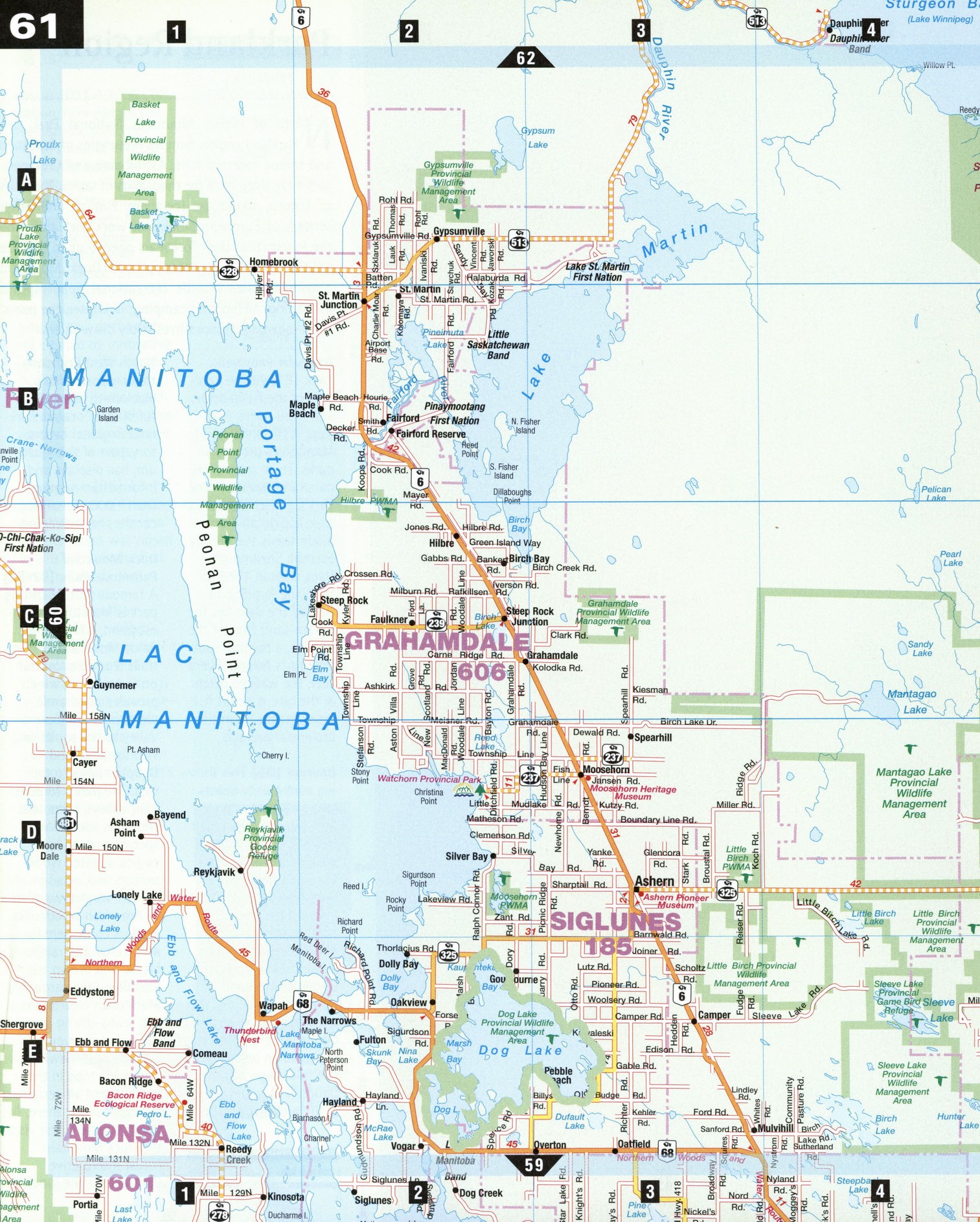
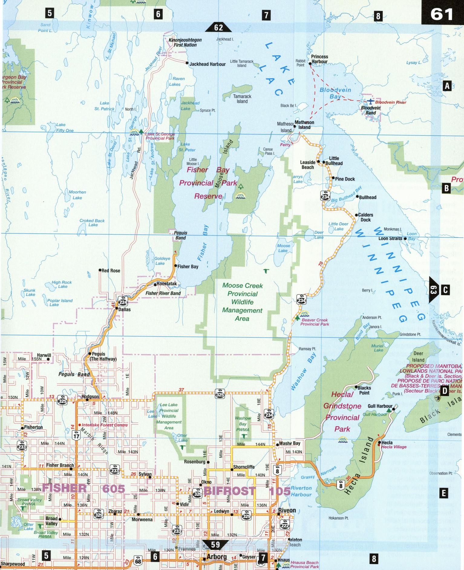
The northern Interlake presents contrasting faces. Lake Manitoba's perimeter is peaceful, with few roads, save for Highway 68 which conveniently connects the west and east shores at The Narrows. Although settlement is spare, summer cottages dot the lake's peaceful east shore. Lake Winnipeg's west shore is livelier, boasting one of Manitoba's most pleasant getaways, Hecla/Grindstone Provincial Park, open to visitors and sports enthusiasts year-round.
Bacon Ridge [E1] A kilometer southeast of this spot lies an ecological reserve recognized by the World Wildlife Fund. Visitors can explore several kilometers of trails where wildflowers grow abundantly and migrating birds touch down in spring and fall.
Hecla/Grindstone Provincial Park [D8]
The islands of this park stretch like stepping stones from west to east across Lake Winnipeg. Hecla Island receives most of the park's visitors. The island, named after volcanic Mount Hekla in their native land by Icelandic settlers, is the recreational hub of this all-season playground. Trails for hiking, walking, and cycling in summer, and for crosscountry skiing and snowmobiling in winter, enable easy exploration of the park. The self-guiding Hecla Village Trail passes through the pioneer fishing village, which tells the story of the Icelanders who came here in the 1870s. A 7 km lakeside trail links the village and Gull Harbour at Hecla Island's northern tip, where an 18-hole golf course and a boat anchorage await. The park's viewing tower and boardwalks are ideal spots for observing waterfowl and other birds, as well as moose.
Steeprock [C2] Eons of erosion have created a stunning setting of cliff and beach at this remote beauty spot, just west of Faulkner on Provincial Road 239.
The Narrows [E2] This strait tightly cinches Lake Manitoba at midsection. For thousands of years, native peoples came to this ethereal place to hunt and fish. They believed the sound of the strong winds and the waves crashing on the lakeshores was the voice or drumbeat of Manito-bau or Manito-wapau, which translates as "the strait of the spirit." The Indian words may be the source of Manitoba's name.
Thunderbird Nest [E1] Interpretive signs tell the history of this sacred aboriginal site, tucked away in an oak forest, just 3 km south of The Narrows. The site-a rock formation shaped like a bird nest on the ground-is dedicated to Thunderbird, a powerful spirit in aboriginal belief. Ojibway (Anishinabe) people still perform ceremonies here.
LOCAL LORE
Thunderbird's Tale
One of the few pan-cultural Native North American myths, Thunderbird is often described as a super eagle, capable of transforming into a man and able to cause lightning by flashing his eyes. He was thought to be the guardian of mankind, yet legend says it is very dangerous to approach a Thunderbird nest; many allegedly have died in the attempt, swept away by ferocious storms. The fact that Thunderbird is both protector and liberator is thought to have roots in the way thunderstorms and violent weather are seen by native tribes: on the one hand, Thunderbird brings life-giving rain; on the other hand, he brings hail, flood, lightning and fire.