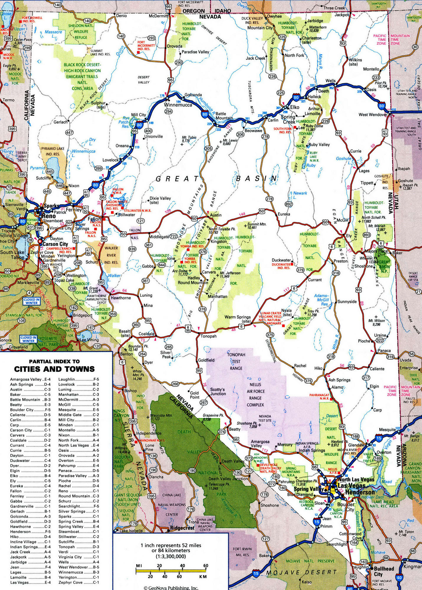
Nevada road map with distances between cities
Nevada map highway free
Highway map of Nevada state. Detailed highways and roads map of Nevada state with cities and towns. Nevada road map with exit numbers.

Nevada roads map
Highway map of Nevada 2021. Free road map of Nevada state.
Funny and true nicknames of the state Nevada
- Battle Born State (refers to the fact that Nevada joined the Union during the Civil War)
- Sagebrush State
- Silver State (currently used on license plates)
- Casino state
- The Silver State: Comes from the large amount of silver deposits in Nevada. The nickname has been found as early as 1863.
What are the unofficial nicknames of Nevada state?
- Mining State
- Silverland
- Sagebrush State: Refers to the prevalence of wild sage which grows there.
- Sage State
- The Sage-Hen State: The sage-hen or grouse is common to the west, and many of them exist in Nevada.
- Sierra Nevada Territory: The dominating mountain range in Nevada.
- Sierra Plata