Road map Manitoulin Island surrounding area (Ontario, Canada)
Road map of Manitoulin Island
Map of Manitoulin Island. Detailed map of the highway and local roads of Manitoulin Island with cities and towns.
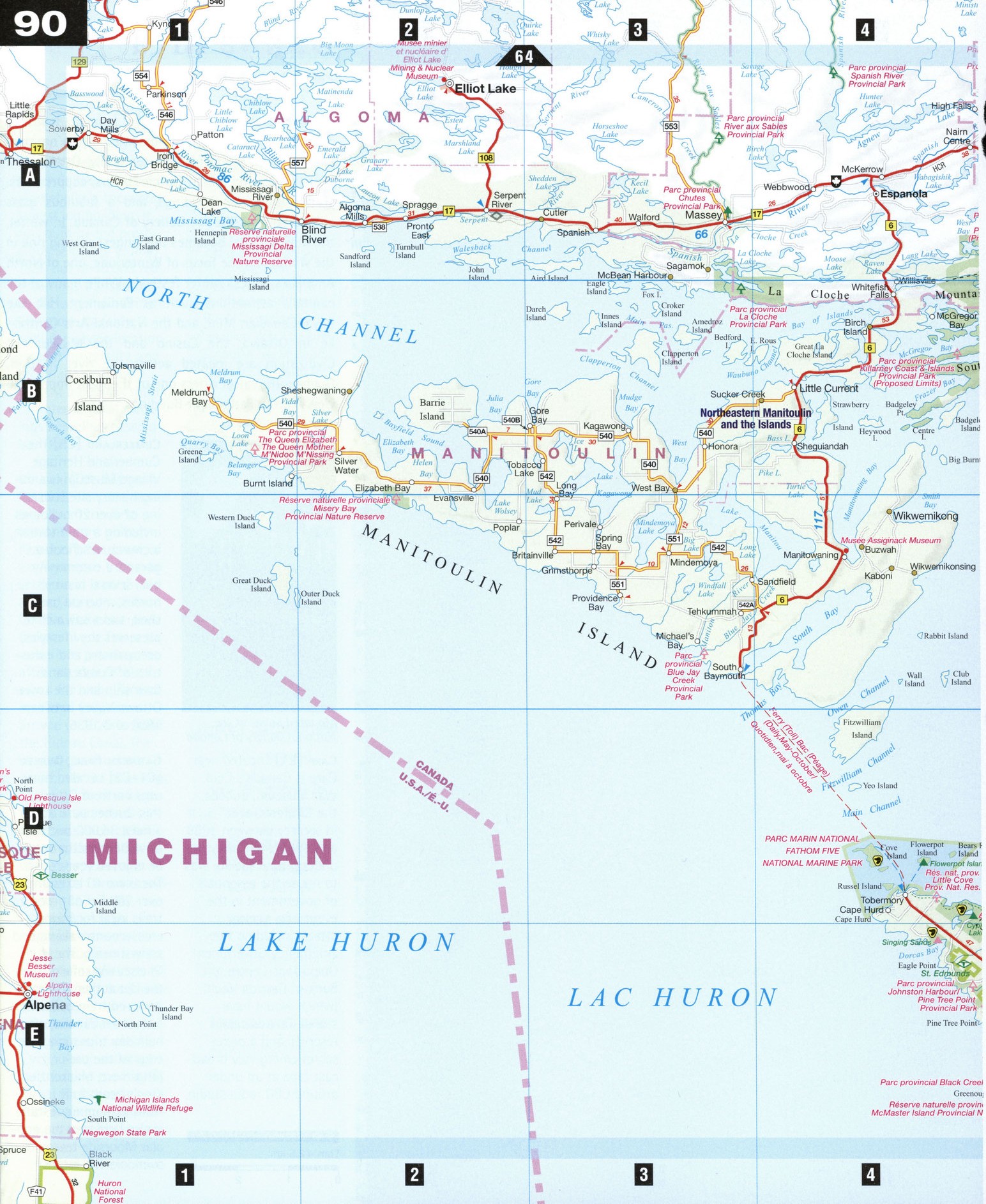
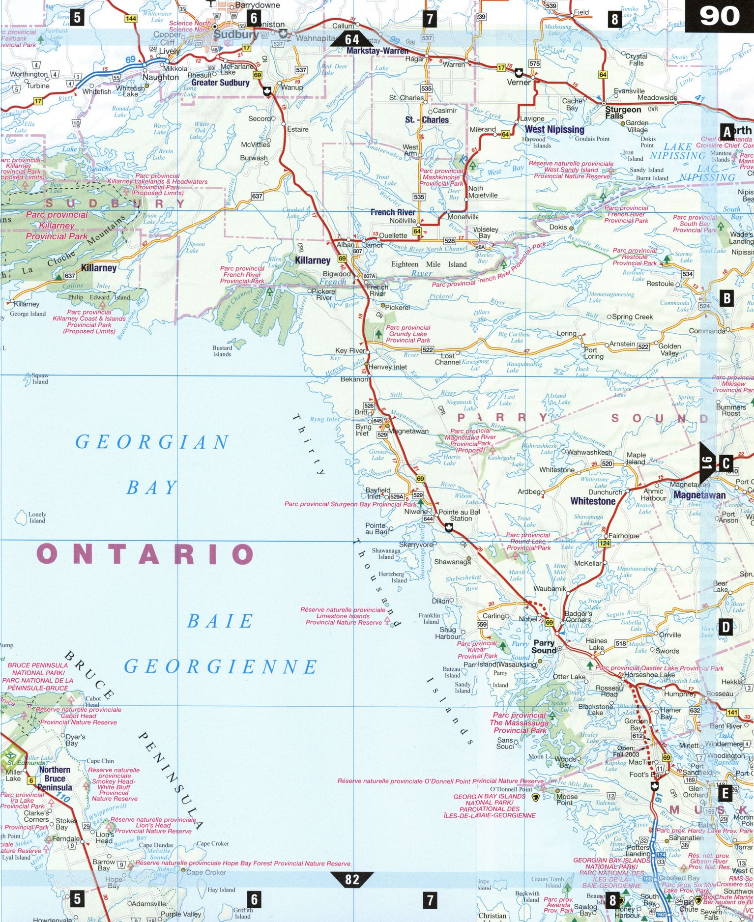
Large scale map of Manitoulin Island
Map of Manitoulin Island. Detailed map of the highway and local roads of Manitoulin Island with cities and towns.
Manitoulin Island
The largest freshwater island in the world, Manitoulin Island is a treasure trove of Native history, good camping, and great fishing. Getting there from the Bruce Peninsula via the Chi-cheemaun ("Big Canoe") car ferry is a pleasant alternative to the drive around Georgian Bay. Off the island, the mainland is crisscrossed with historic canoe routes-the historic French River follows the path of the voyageurs and the fur trade-and marked by natural splendor. Killarney Provincial Park, one of the crown jewels of Ontario's parks, has sapphire lakes and jack pine ridges so beautiful the illustrious Group of Seven painters persuaded the government to preserve the area as a park.
Elliot Lake [A2]
Nestled within the Precambrian shield on the edge of the boreal forest midway between Sault Ste. Marie and Sudbury, Elliot Lake is a haven for those who truly enjoy outdoor life. The town's mining roots can be seen in the Mining and Nuclear Museum. The Fire Tower Lookout is a replica of a fire ranger's lookout, with a fabulous 360° view of the area, including the North Channel of Lake Huron, Manitoulin Island and, on a clear day, the U.S. mainland. Outside of town, the Deer Trail is a 120 km triangular route with stunning scenery. The last weekend in September, artisans along the route open their doors for the Deer Trail Studio Tour. Many charming resorts are tucked in the woods not far from the town.
Killarney Provincial Park [B6] Located on Georgian Bay, the rugged wilderness of Killarney Provincial Park inspired the Group of Seven and is renowned for its scenic beauty, canoe routes, and back-country camping. The La Cloche Mountains, located within the park, tower 396 m above the lake. La Cloche's white-quartz cliffs (reminiscent of the white cliffs of Dover) are visible from 48 km away.
Manitoulin Island [B1-C4] Stretching 176 km long and varying in width from 5 to 80 km, Manitoulin is the largest freshwater island in the world. Over 100 inland freshwater lakes on the island offer excellent fishing, hunting, camping, boating, and scuba diving. There are numerous hiking trails, many with spectacular scenic viewpoints-Kagawong trail, for example, goes to Bridal Veil Falls. The North Channel, between Manitoulin and the mainland, is popular with sailors and there are many excellent marina facilities on the island. Ш Manitoulin boasts a wide range of activities— from a leisurely walking tour of the hamlet of Kagawong, a refuge from the outside world with its century-old buildings, to the Gore Bay Museum, where relics of the ancient Sheguiandah native race are on display. The Mississagi Lighthouse reveals the life of a 19th-century lightkeeper and his family, while the SS Nor isle tour at Manitowaning gives a full view of the workings of a large Great Lakes ship. At West Bay, the Ojibway Cultural Foundation has an arts and crafts shop and an aboriginal chapel, which along with the many small museums scattered across the island, will give a glimpse of the extensive Native populations that once called Manitoulin home.
Sturgeon Falls [A8]
Originally settled by the Nipissing Ojibway, Sturgeon Falls was once an important fur-trading post. Sturgeon River House Museum, reconstructed on the site of a former Hudson Bay Company post, gives a glimpse of this history. The collection features Native artifacts, pioneer furnishings, old machinery, logging and farming equipment, and artifacts of the fur trade. There is also a working blacksmith's shop on site and a gift shop with locally handcrafted items. Every summer I the Nipissing #10 First Nations Band of Ojibways hold a traditional powwow with drummers, singers, and dancers coming from far and wide to join in.
ATTRACTIONS
ELLIOT LAKE
Mining and Nuclear
Museum Fire Tower Lookout Deer Trail Touring Route White Mountain Academy of the Arts
MANITOULIN ISLAND
Providence Bay Beach
Ojibway Cultural Foundation, West Bay SS Norisle and Heritage Park, Manitowaning Assiginack Museum,
Manitowaning Mississagi Lighthouse, Meldrum Bay Little Current-Howland Museum, Sheguiandah Gore Bay Museum, Gore Bay Gordon's Park
STURGEON FALLS
Sturgeon River House Museum Sturgeon Falls Recreational Complex Ojibway Pow Wow Doll Museum, Shuswap Camp Leisure Farms